Since more than 3 weeks I have been back in Brazil and I am just loving this country.
In my last blog entry, I provided an overview, of my travels and experience from last year – when I worked and lived in Sao Paulo for a couple of months and my recent travels in the north-east and the beginning of my road trip with stops in Costa do Sauipe and Chapada Diamantina.
Crazy Road Trip Part II
From Chapada Diamantina, I wanted to drive to Chapada dos Veadeiros. As this would have taken approx. 12h I decided to stay one night in Barreiras – just in the middle of the two Chapadas. The drive from Chapada Diamantina (Lençóis) to Barreiras was an easy one – the street is in good condition (with a few potholes here and there). The only thing – the street is the main road from Salvador to the inland so many trucks are coming from or going to the harbour and the street has only one lane, which means you often get stuck behind a truck until you finally have an opportunity to pass by.
Barreiras turned out to be the ugliest Brazilian city I have ever visited and the people are super unfriendly. When I arrived at my hostel, I had booked via booking.com, I said the usual thing I say when checking-in (in Portuguese) – Hi. How are you? My name is Stephanie. I have a reservation for 1 night. – I am not yet fluent in Portuguese, but I can at least say this and the women at the reception just blurred back at me that she cannot understand me and what does a non-Brazilian anyhow want here…. Very nice… Then I went to look for a bank with the help of Google Maps. But Google was wrong. There is no bank at this place, but a supermarket (without an ATM). So, I asked the guy at the cashier, where the next bank is, and I just got a very aggressive “Nooo” back. Anyhow, I just stayed there one night to relax and got in my car the next morning to finally reach Chapada dos Veadeiros.
I again just followed the route Google Maps was proposing without checking it in advance… That was a mistake… First, it led to me to a very nice road – almost no potholes. I was driving through the middle of nowhere – no houses, no other cars or trucks, no gas station for about two hours. It was a nice relaxing drive. Back at the main road, I wanted to refuel my car, but the gas station was out of order with the next one 60 kilometers away and Google told me to get off the main road again… At least it said, that there is another gas station on that road as well. Giving that the other road was great, I did not expect anything bad when leaving the main road again. After another 45minutes driving through beautiful nature on a paved road, I arrived in a small village with a gas station and refuelled the car. I continued my way – the road was suddenly interrupted by stony – non-paved parts. I assumed, the road was under construction and kept on driving … a few hundred meters paved – then dirt road again …only that this dirt road did not end after a few hundred meters, even not after a few kilometres… I seriously ended up driving a dirt road for over 60 kilometers… I checked, whether turning around makes sense, but the only route – I was certain was not on a dirt road – would have required me to drive back almost completely to Barreiras… So, I thought “no, you will continue, the dirt road will probably end in a kilometre”… hahaha. Below some pictures, of the nicer part of the dirt road – when I am afraid I don´t take pictures.

I grew up in the countryside, my parents used to have some land with apple trees and other fruits and when we went there, we also had to use a dirt road (only few hundred meters), so I was confident, that I can handle it. There were parts of the road when I was about starting to cry. So many potholes and deep potholes, that driving slalom was not enough. On some parts of the road, there was so much sand, that I was afraid to get stuck – I was driving a small car – not a 4×4 jeep – I just had a tiny Renault Kwid. It also happened that suddenly plants/trees grew on the street and you had to suddenly change the side – good that there is not much traffic – so I used the other lane most of the time – always trying to follow the tracks of other cars or trucks making their way through it. I also had to cross two bridges – two very simple bridges – there were only a few tree trunks and I had to ensure to drive directly on them since there was the risk that the wheel gets stuck in the space between them. You have no idea, how excited I was when Google Maps told me, that in 20 kilometers I must turn right to get on another road… These 20 kilometers just took me 1.5hours just to notice, that the other road is also a dirt road… But after 4 more kilometres, I finally arrived back at a paved road. Enough adrenaline for today – at least that is what I thought…
I was back in civilization – other cars are on the street; I even came through a village… and then it happened… I was driving behind another car, which was already driving a little bit faster than allowed, so I decided to just follow him. Another car came and surpassed both of us while driving up the hill. When I reached the top of the hill all I saw was smoke. The car in front of me hitting the break – me hitting the break…. then I saw first a burst tyre on the road and then skid marks leading to the other lane and ending in the ditch; A car lying on the side… Gosh …. was I afraid, in my thoughts I already went through the first aid training I received more than 10 years ago… I stopped my car and when I and the driver from the other car, reached the ditch — the driver was already climbing out of his car. When he said, that he is alone and that no one else is in the car, I was so relieved. He was fine – i.e. no (visible) injuries and he seemed to have a clear mind – he refused to call an ambulance to get checked out… (hope he did not have a concussion or similar). One thing I found awesome: all cars coming this way stopped and asked how they can help – no one was posing for stupid ” #firstresponder selfies” or similar. Everyone was super helpful. When I see how things are going in Germany…It became quite frequent to hear in the news about people blocking police or ambulance cars to take pictures and to gaze or even attacking doctors who are just trying to save a life…
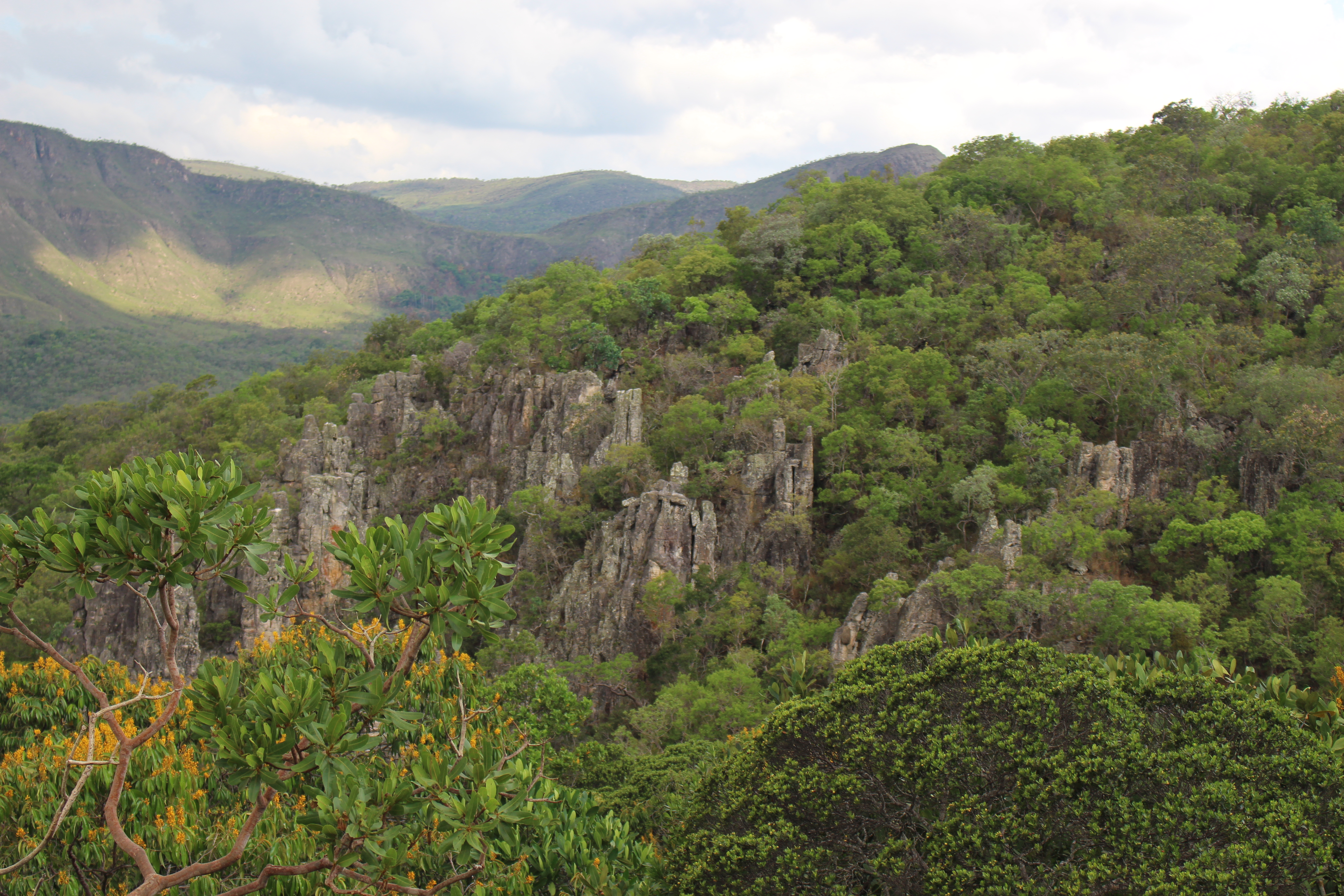
Chapada dos Veadeiros
Anyhow after all this adrenaline, I arrived in Chapada dos Veadeiros. I stayed in a very nice hostel in Alto Paraiso. The owner immediately explained to me how I can explore everything by myself and even gave me tips when to do what. There is a nice map for tourists showing the different attractions and mentioning, which can be visited with a normal car and for which a 4×4 is required. It also provides the information on how many kilometres you must drive on a paved road and on a dirt road to arrive at the parking lot of the respective attraction. It also stated how many kilometres or meters you must walk. However, it just states the distance one-way, so for example if it says 5km, it is 10km in total as you probably want to go back sooner or later.
Google Maps is here also surprisingly good. For one attraction (Catarata dos Chouros) I had to switch to “bicycle” mode, though the (dirt) road is for cars as well. Usually, you will also find signs on the road to lead you the right way.
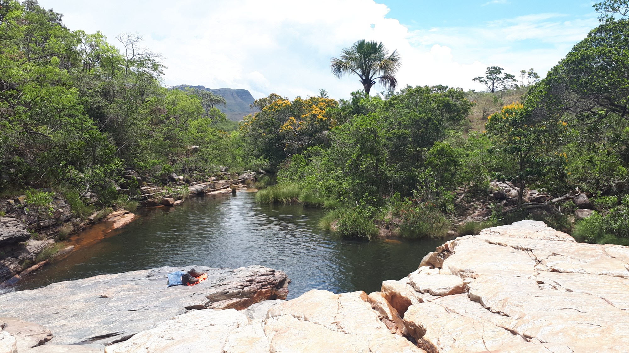
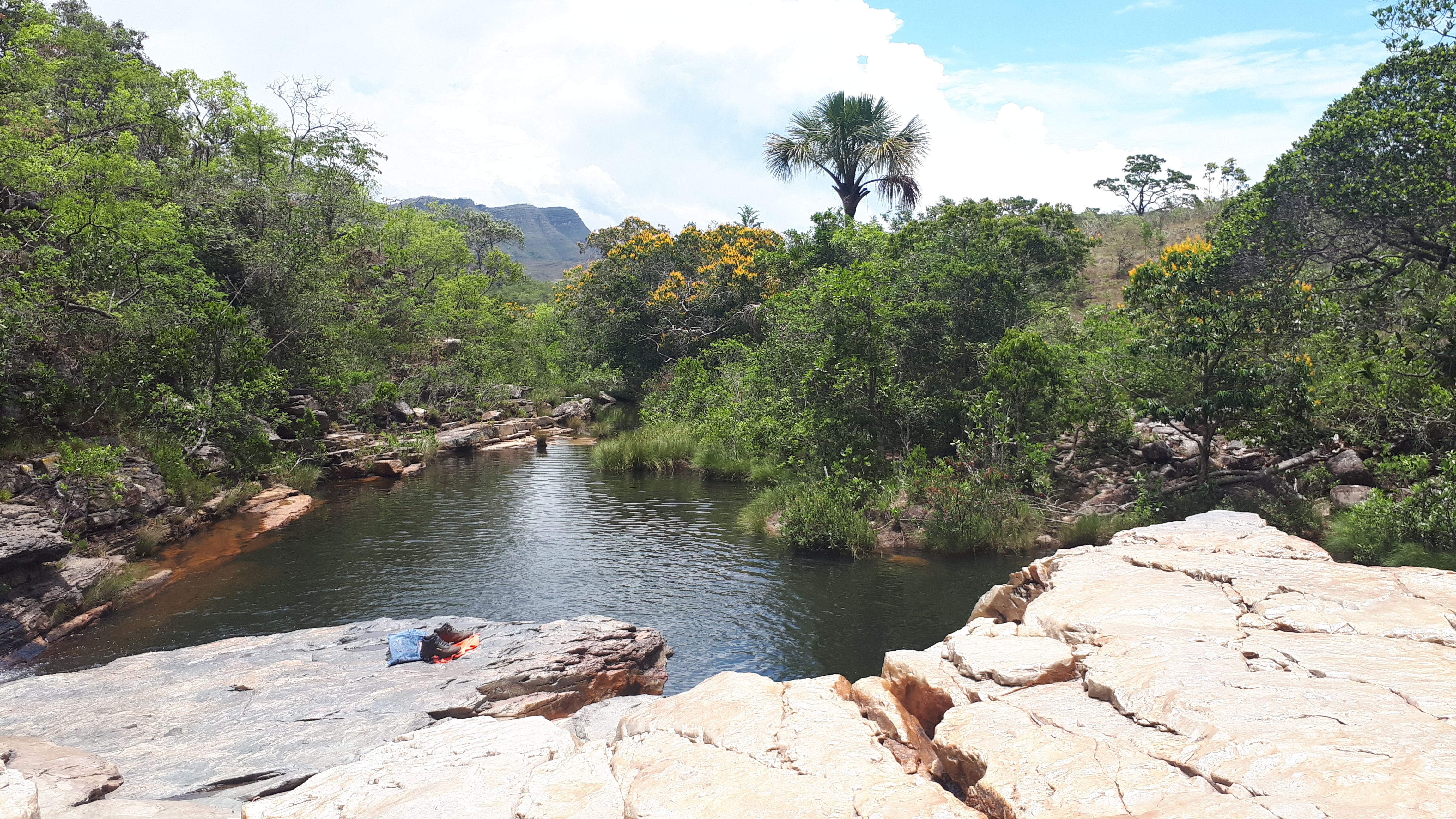
So, I went to the Cachoeira dos Crystais in the afternoon and had a relaxing walk along the small river seeing hundreds of tiny waterfalls. If you go there, make sure you follow the little paths across the first tiny river. There are I think 3 streams of the river and the hidden waterfalls are even more beautiful than the ones next to the main path.

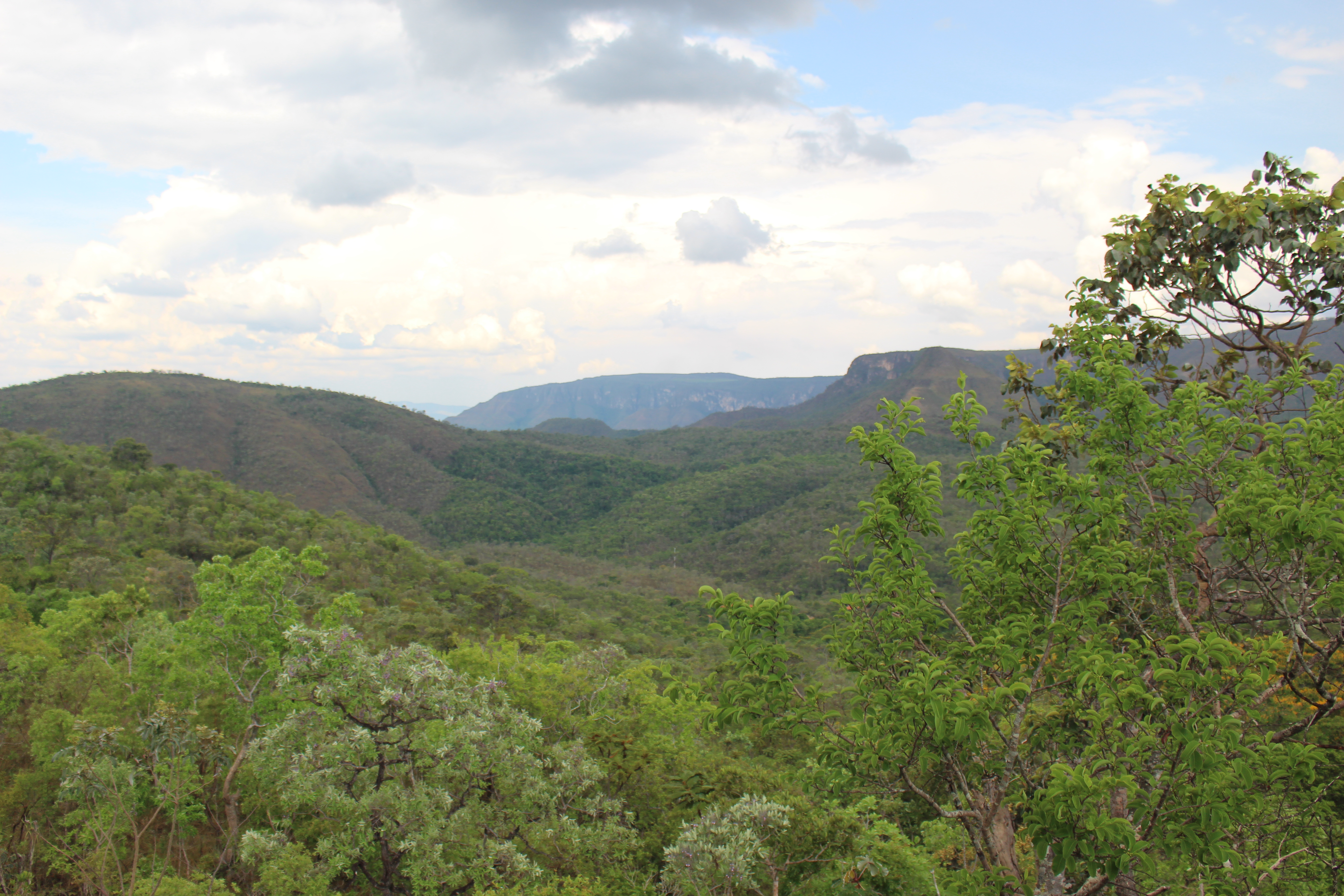
The next day I went to the Vale de Lula. It is quite close to the national park and Sao Jorge. Vale de Lula is called “Moon Valley” as the stone formation looks a little bit like the moon. I followed the path and first came to a viewpoint overseeing some rocks. It does not look like the moon, but it is a nice place to rest and just enjoy the beautiful nature. Once I have reached the river, I noticed, why this valley is called moon valley – the water has done an amazing job shaping the rocks the way they are today.
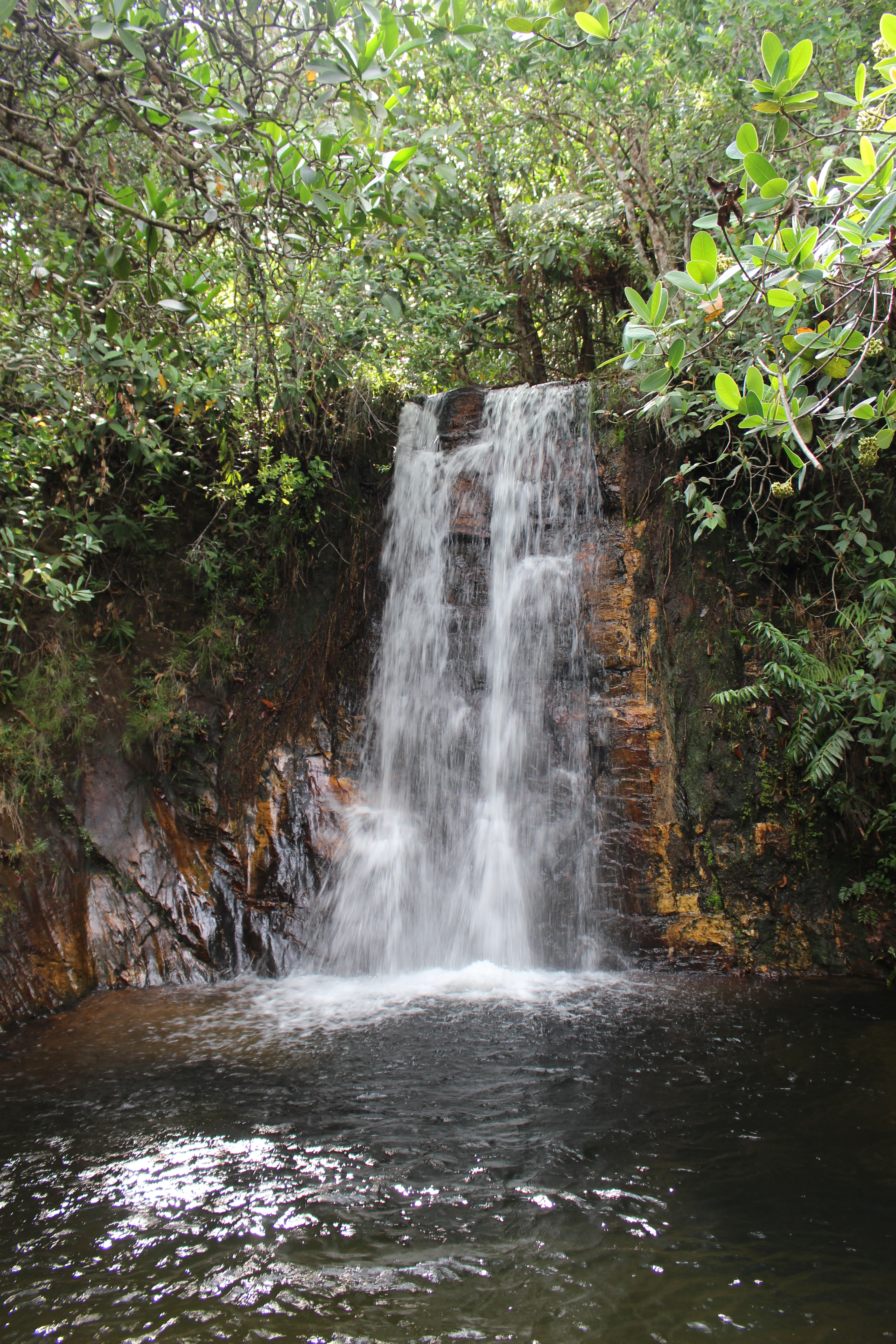
After this I went to the Fazenda “Sao Bento” (St. Benedict), you must pass through this Fazenda if you want to see the Cachoeiras Almécegas I and II. The Sao Bento waterfall close to the entrance is not very interesting, you can skip this. But Almécegas I and II are beautiful. Brazilians are not so much into hiking (at least most of them), therefore each of the waterfalls has its parking lot to ensure you only must walk maybe 2km in total. Even though the distance is short, I was glad that I was wearing my sneakers. I saw people walking in flipflops or even barefoot, however, due to the stony path, I prefer sneakers. In Almécegas II I also took a refreshing bath, the water was very cold, but on a hot day, it was perfect. October is rainy season in Goiás, so just after noon a thunderstorm set in and I returned to Alto Paraiso and just relaxed in the afternoon.
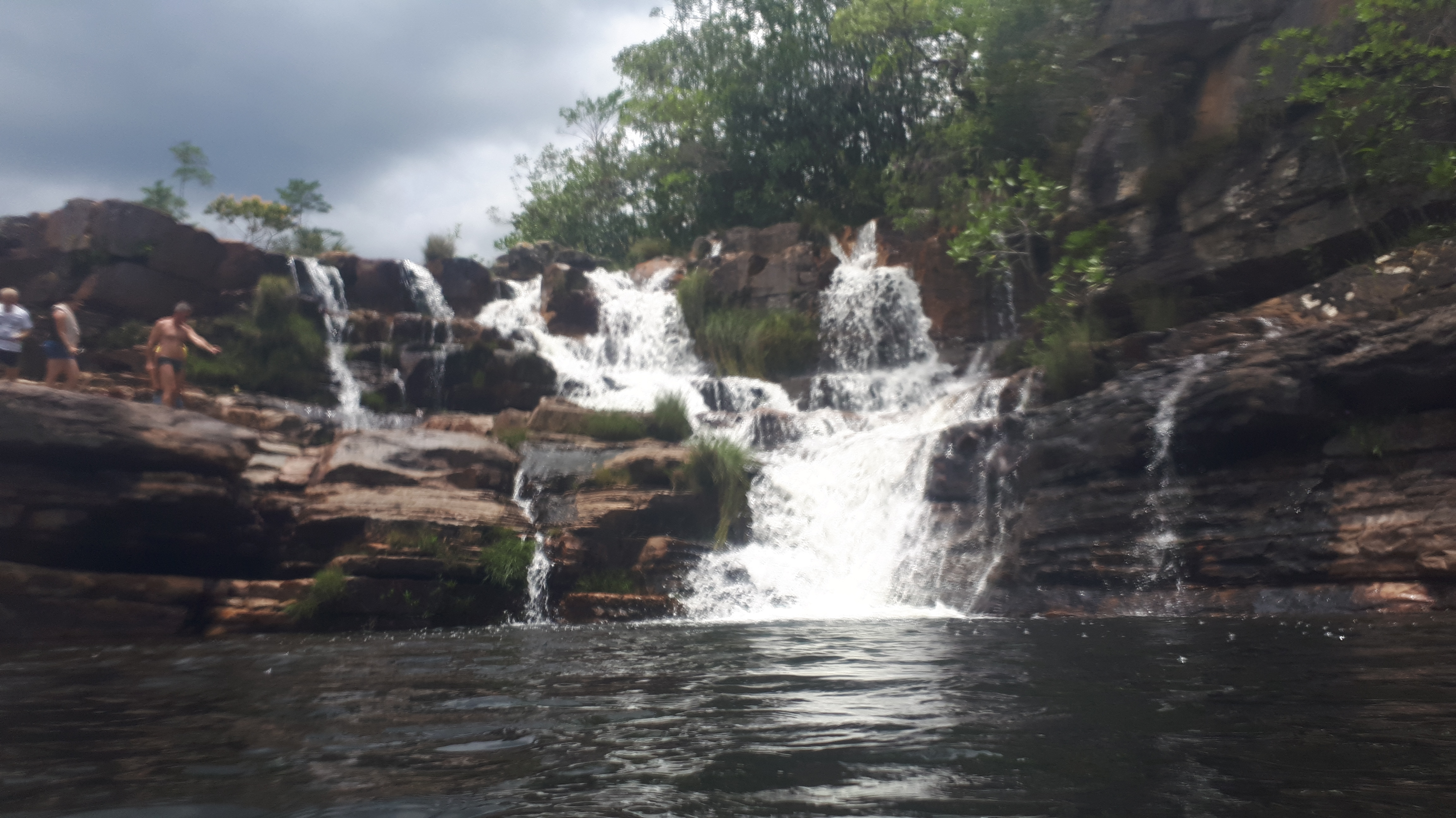
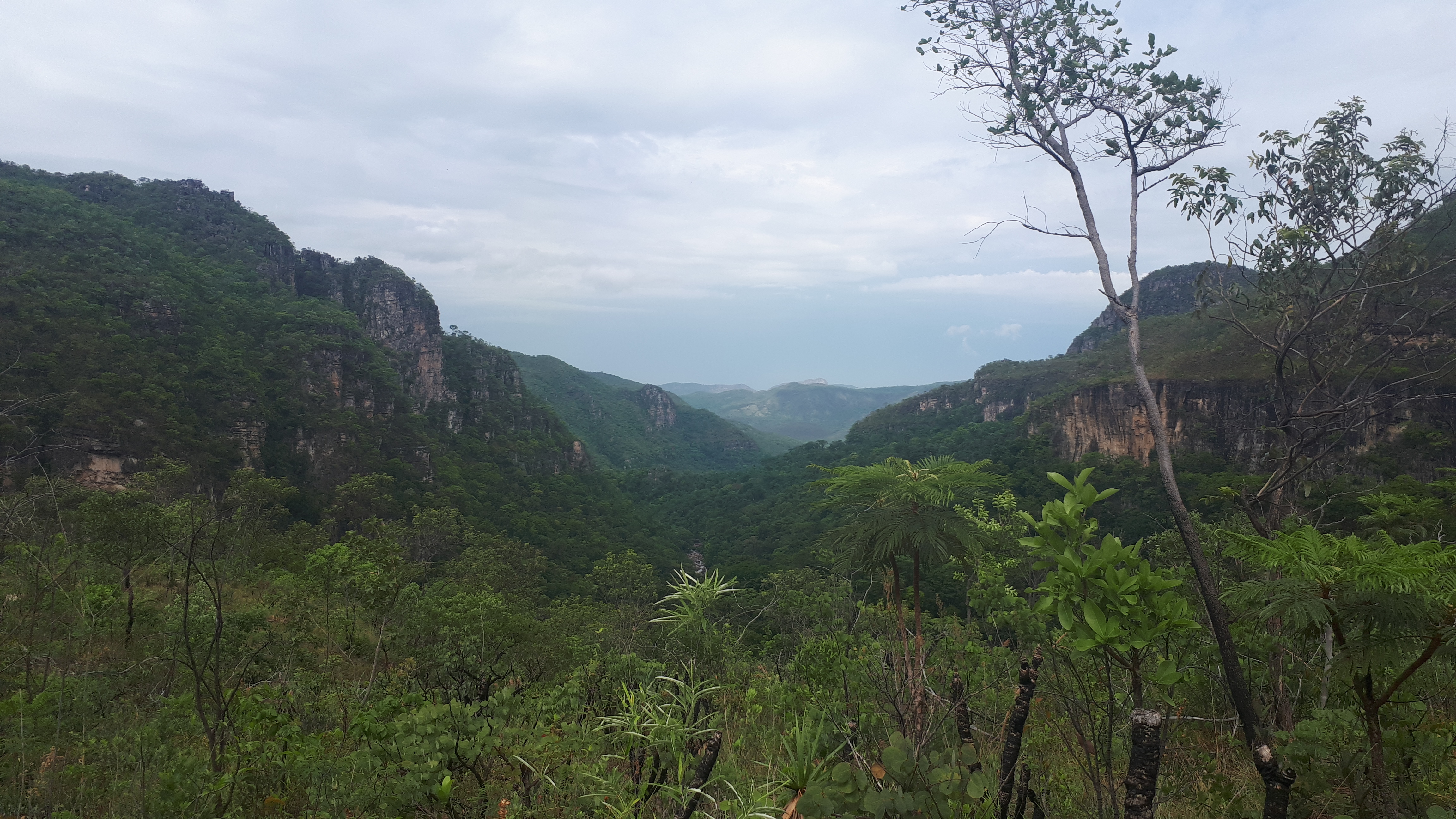
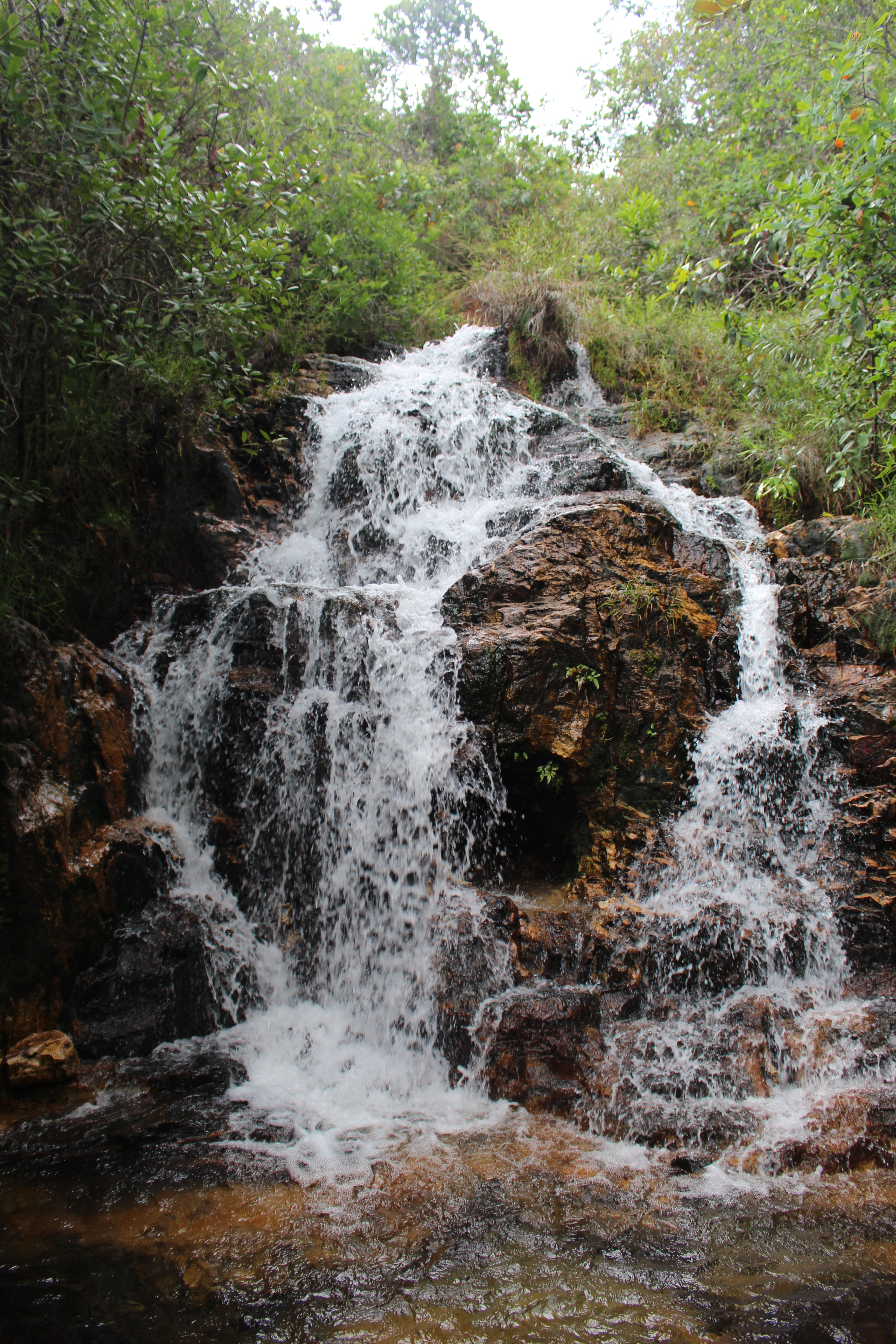
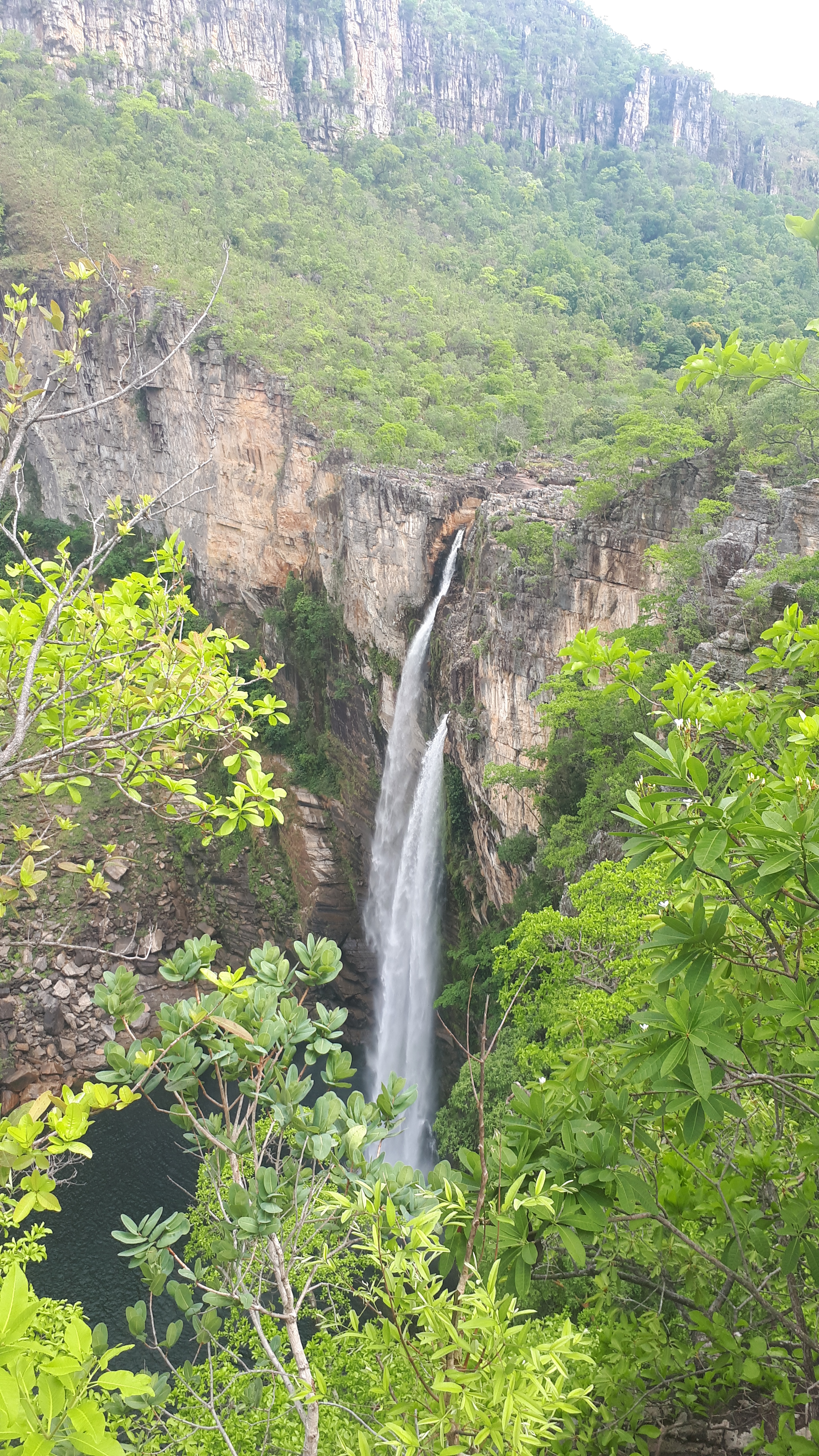
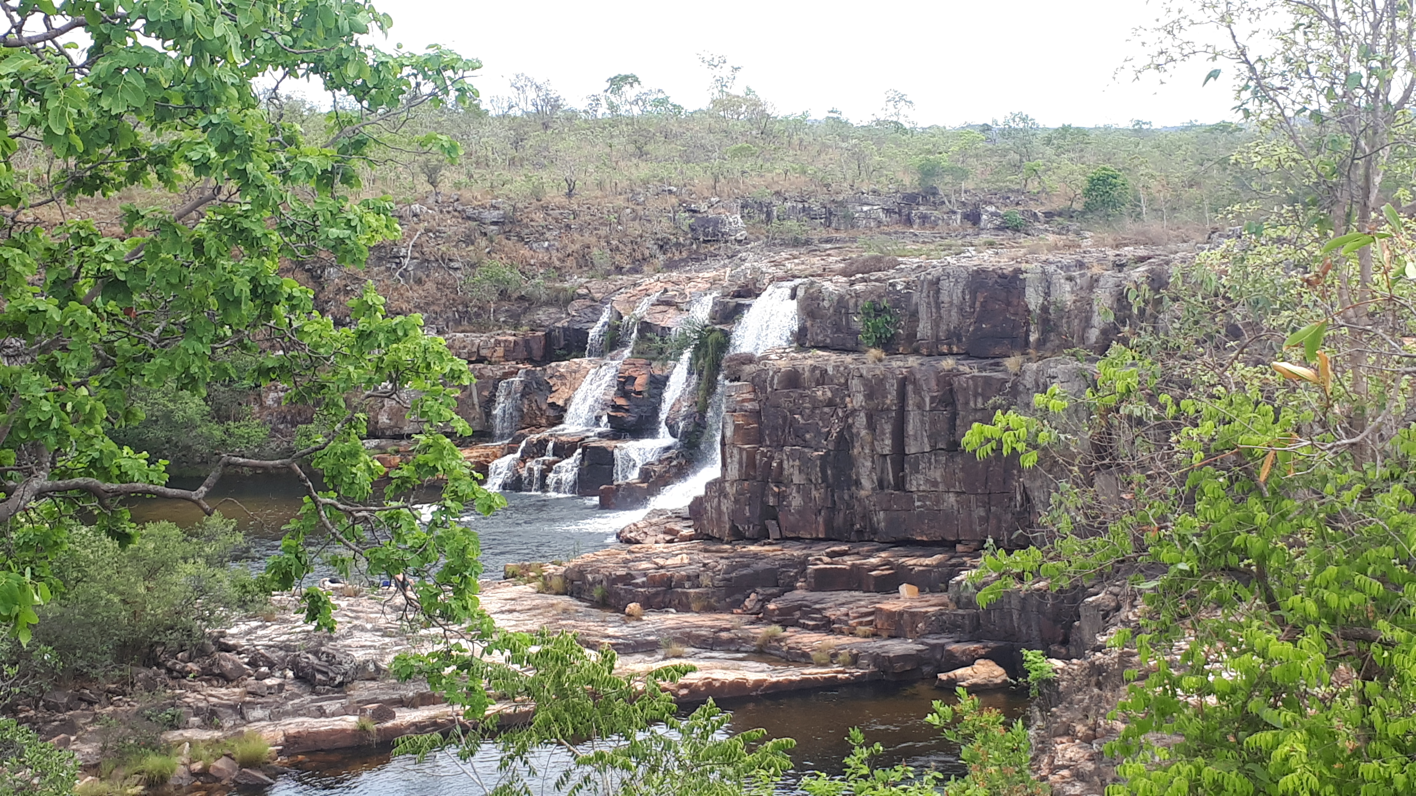
On the next day, I went to the national park. This park is -the only park I know in Brazil – you can visit without a guide. At the visitor centre, you will be provided with information on the different hiking trails and the attractions you can see. There is one short circuit of only 2-3km and the longest one is about 30km. The visitor centre recommends getting in touch with them in advance if you like to take this tour as you might require staying a night in the park. There are two further circuits both around 10-12km in total. The yellow path leads you to three beautiful waterfalls and a place, where you can take a relaxing bath. Most of this path is flat, only the way down to the two waterfalls “120m” and “80m” is steep and of course, you must get up again. I planned to do both the yellow trail (waterfalls) and the red trail (canyons) in one day. The guy from the visitor centre recommended me to do the yellow trail first given that it is a little bit more exhausting than the red one and only do the red one if I am back from the yellow path around 12/1 pm and still have enough energy to hike 10km more. Challenge accepted I was back from the yellow trail at 12 even with taking a bath. However, the bath was rather short – the tiny fished started to nibble me.
I already heard some thunder when going back the yellow trail, but I had the hope, that the rain and the thunderstorm would not pass over me. Many people were still walking in the opposite direction. But yeah, I had just completed half a km when it started pouring. The path was suddenly not a path anymore, but a river. And thunder and lightning were also suddenly directly over the park. As a kid, I have learned, never to be in a forest or similar during a thunderstorm, but always search for a building or – if needed a cave- to be protected from the lightning. So, I decided that it is too dangerous to continue and returned to the visitor centre, which was not that easy given that the path was very slippery, a brown river and you could not see the bottom anymore. Sometimes I was not sure, whether I am still on the path or not, but gladly every few 100meters a sign had been put up. When I arrived back at the visitor centre, I was completely wet though I wore a rain poncho… In the centre was only another couple, it seemed that all the people I met where still out there in the park. I waited until the rain became less heavy – still, no other people returned from the park. Seems I was the only person not feeling comfortable being in the park during a thunderstorm.
So, unfortunately, I could not make the red trail and see the canyons. Maybe another time.
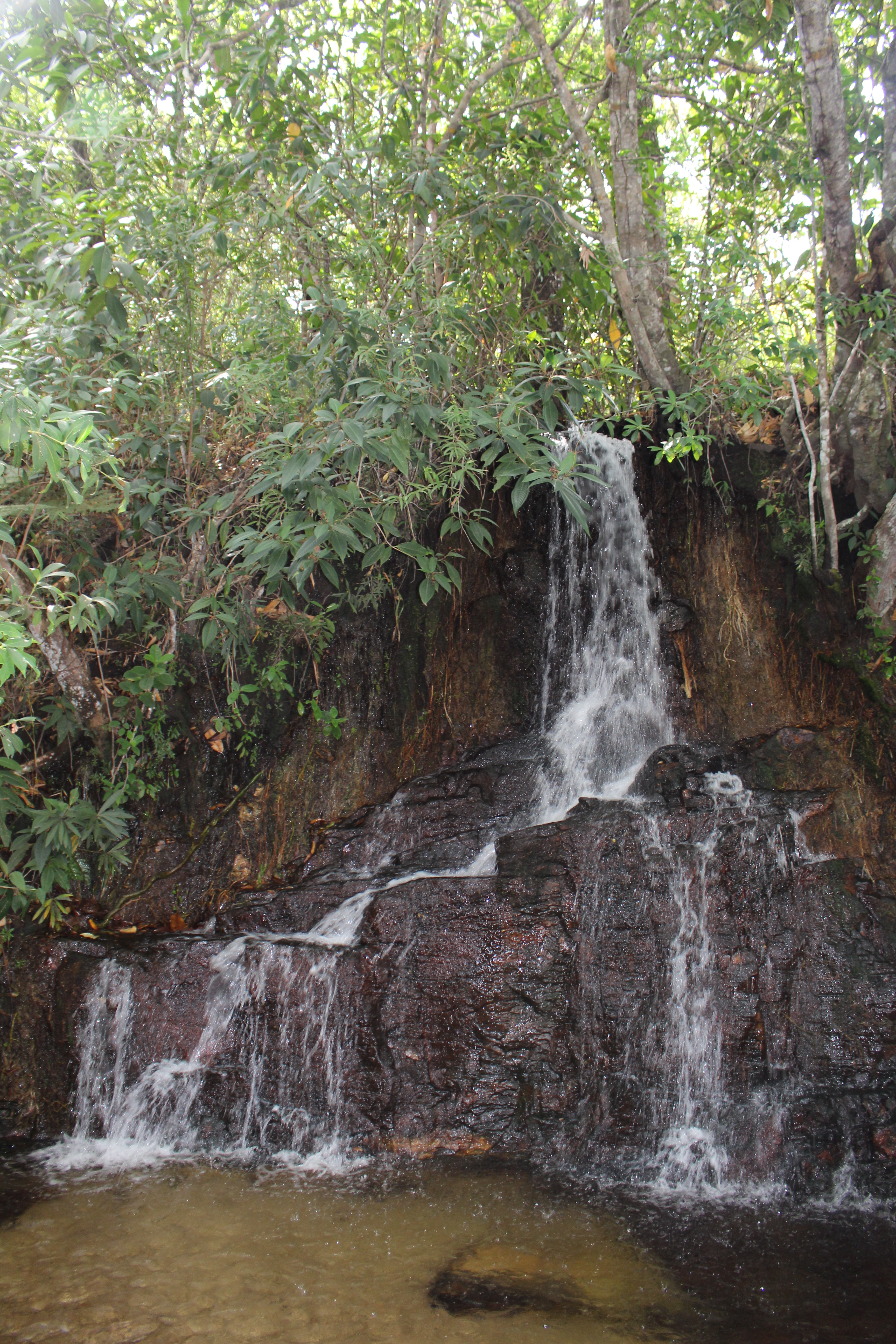
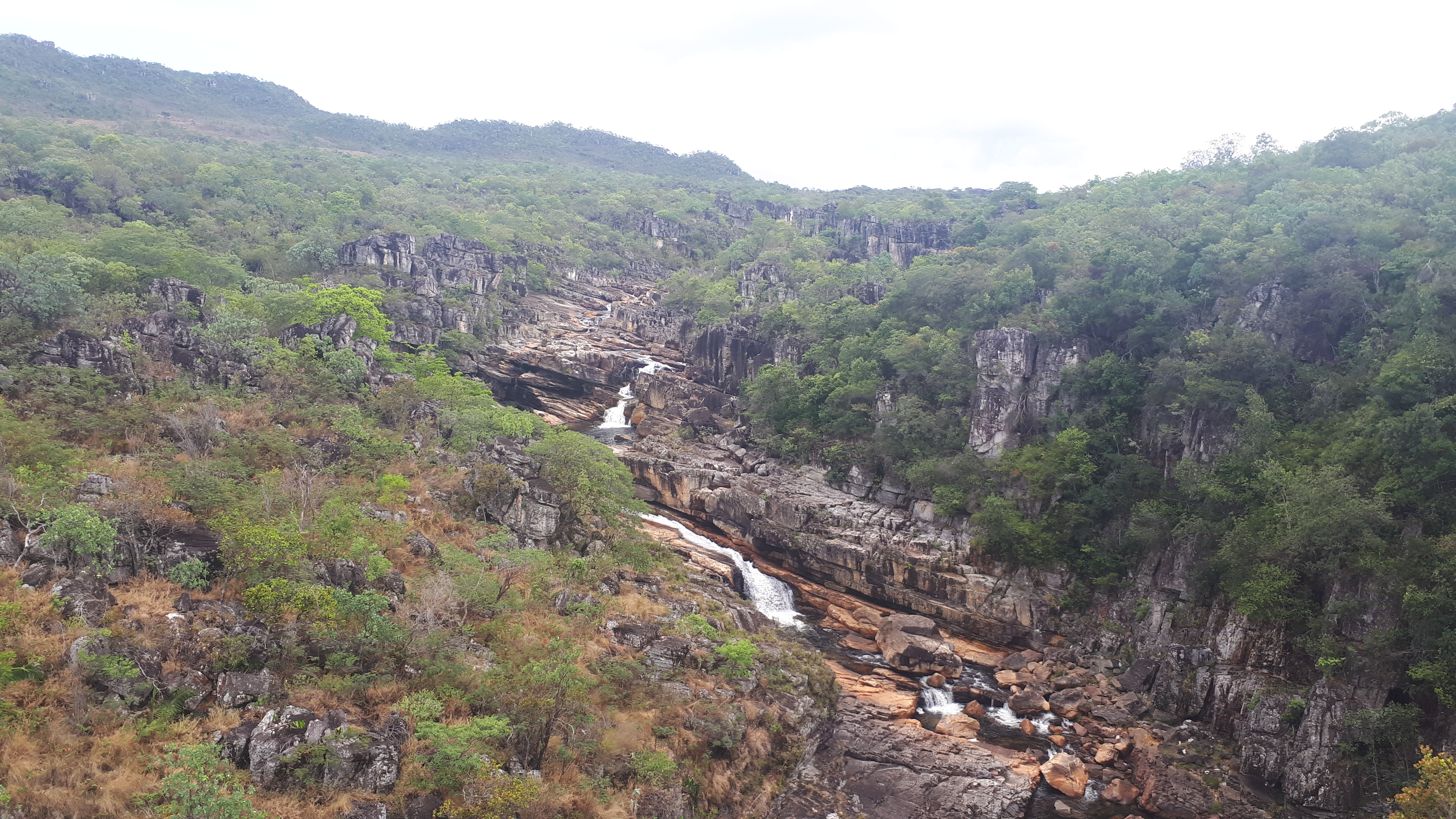
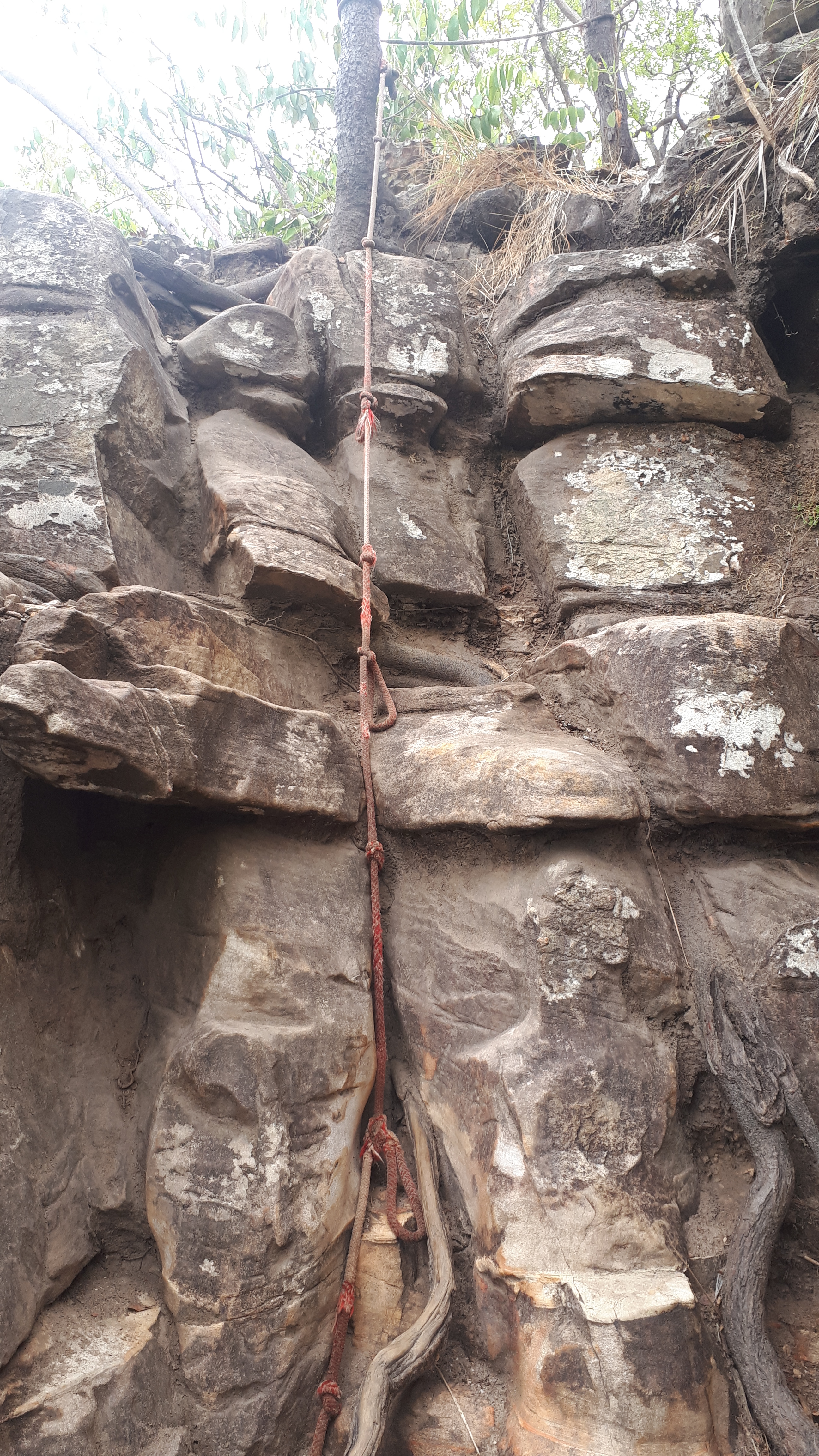
The next day I was driving to Brasilia with a stop at the Catarata dos Couros. It is called Catarata and not Cachoeira as it is a bigger waterfall. After 18km on a paved road, I again had to drive 35km on a dirt road to arrive at the parking lot. The Catarata is one of the view attractions, you do not have to pay an entry fee. The beginning of the trail is easy to find. After 5 minutes I saw a waterfall and was surprised as the waterfall was rather small. A glance at Google Maps revealed that this waterfall is only the Cachoeira da Muralha. The Catarata is further downstream. In the beginning, the trail was easy to find, but I recommend getting a tour guide for this one. Many tiny trails are leading to different viewpoints and there are sometimes difficult to find. I wanted to get to one viewpoint on the other side of the waterfall. I saw some people (with guide) sitting there, but could not figure out how to go there, I ended up walking in circles and finally gave up. I wanted to ask a guide, but there was none in reachable distance. The trail is also sometimes a little bit difficult, making the use of hands necessary. When I went down to the waterfall, I even had to climb a few meters down with the help of a robe, but somehow when I went back I did not pass by this part anymore, so seems there is another way not requiring you to climb.
Brasilia – the capital
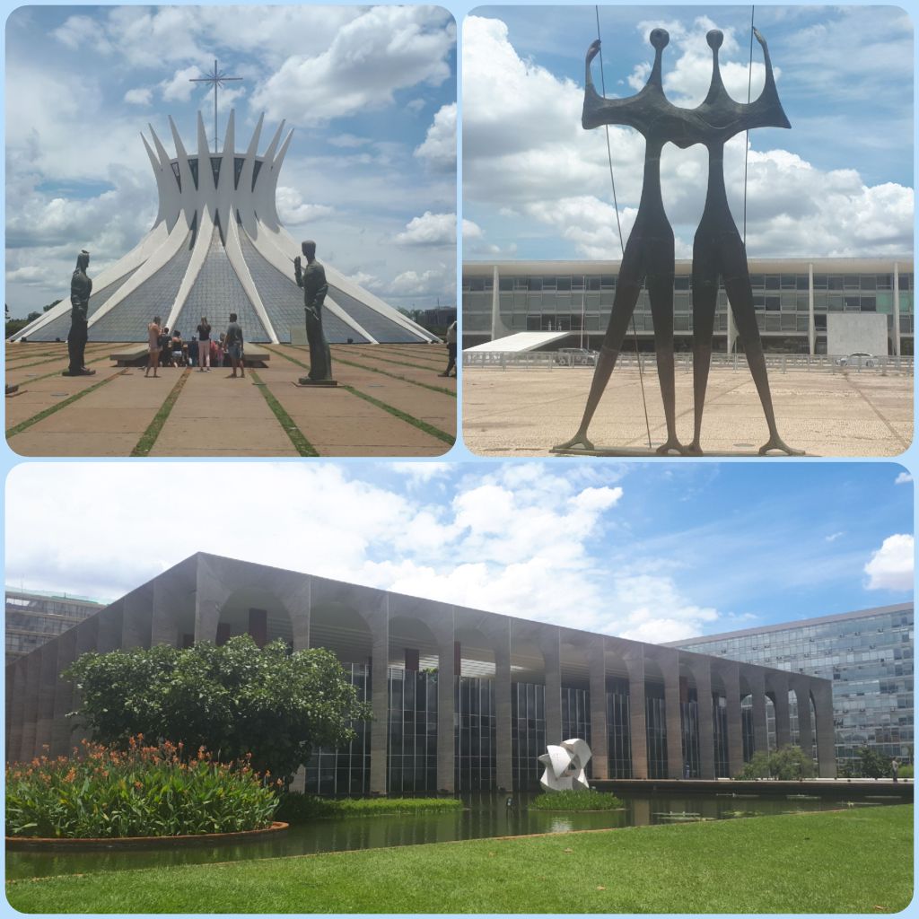
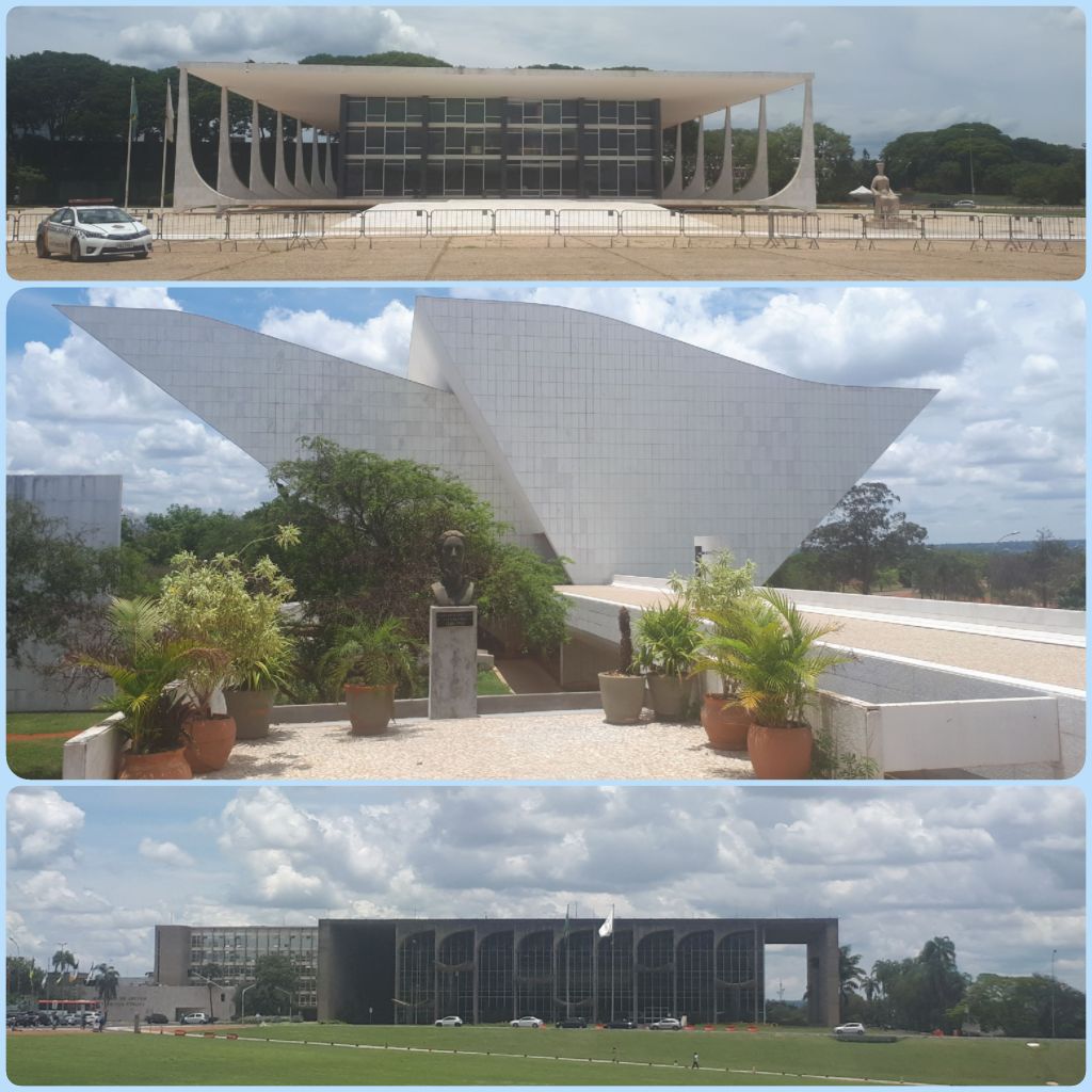
Brasilia – the capital of Brazil. My first impression was that the traffic is good. In Rio and Sao Paulo, you always have traffic jams during the day, in Brasilia, I haven`t seen one though streets are usually busy on Friday afternoons. Probably this is because Brasilia is a city which has been planned, while other cities just grew over time. The architect Oscar Niemeyer has a huge influence on Brasilia given that many buildings were designed by him. In the city centre, you will find many governmental buildings designed by him, like the cathedral, the “Praca dos tres poders” (Three powers plaza), which is surrounded by the supreme federal court, the national congress and the Presidential Palace. Brasilia also has some beautiful parks, like the botanical garden and the Parque Nacional de Brasilia.
From Brasilia, I returned to my beloved Sao Paulo. My new and old “home” for the next couple of weeks 😊
Unfortunately, my SD Card Reader is striking again…So sorry for the low quality pics from my mobile phone.
